Top honours for CFA-led research team
.jpg)
A CFA research scientist and her team have won top honors at the inaugural Natural Hazards Research awards for their work in predictive fire mapping.
The research award was presented to Dr Chloe Begg (CFA) and her team which is made up of personnel from three Australian universities and representatives from emergency management organisations from across the nation.
The project, funded by Natural Hazards Research Australia, is being led by CFA and the Victorian Department of Education and explores how predictive fire spread maps can assist the public in making decisions in emergency situations like bushfires.
The project was born after the 2019-2020 bushfire season when NSW and the ACT released “Red Maps” to the public but due to the number and scale of fires, there was a need identified to show the current and potential impact of them.
Dr Begg said fire spread predictions had already been used in Victoria, NSW and the ACT but there is interest from other jurisdictions to use them in the future.
“The project provides an opportunity to use research and collaboration between fire agencies to ensure that the future use of these products is well considered and evidence-based,” she said.
Dr Chloe Begg said the team has conducted multiple studies with community members across Australia to understand what information Australian’s are looking for when using maps during an emergency.
"Predictive fire spread maps are different to existing warnings, such as those on platforms like VicEmergency," she said.
"We are exploring how fire spread predictions can exist within the current warnings landscape to provide even more information on what is likely to happen to give people more time and context to make decisions about their safety."
The research is already being used to inform fire agency practice.
"At the end of last year, Emergency Management Victoria asked us to provide guidance based on the research to support the creation of predictive fire spread maps,” Dr Begg said.
“This guidance was used to support the creation of maps that were published ahead of severe weather conditions forecasted for Boxing Day."
The next phase of community research focuses on testing a range of different designs to understand how best to present the maps with information that community members are looking for.
The team will continue to work together to ensure the research findings are useful and usable for all Australian fire agencies. The project is due to be completed by the end of 2026.
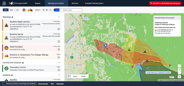
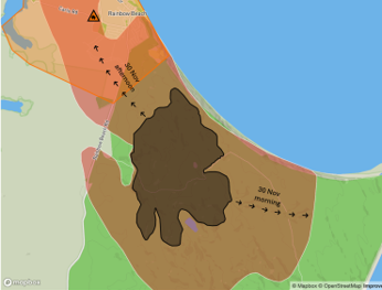
 An example of the mapping developed
-
 An example of the mapping developed
-
-
-