Help CFA map Total Fire Ban roadside signage across Victoria
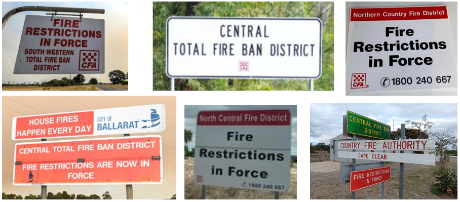
As part of planning for the implementation of Victoria’s new Fire Weather Districts, CFA is gathering information about roadside signage that displays Total Fire Ban (TFB) District information across the state.
There are many different types of TFB signs in use across Victoria, with responsibility for managing them often shared between local brigade members and councils. Understanding where these signs are located, what information they display, and their condition will help CFA determine the most appropriate approach for any future updates.
Some signs may need to be updated, replaced or reviewed as part of this project. However, before any decisions can be made, we need a clearer picture of the signage currently in place.
Volunteers and staff are encouraged to complete the Total Fire Ban District Roadside Signage Survey.
Information can be submitted for individual signs through the survey, or details for multiple signs can be emailed directly to afdrs.cfa.implement@cfa.vic.gov.au.
The survey seeks information about:
- Sign location
- Type of signage
- Information currently displayed
- Current condition of the sign.
Many roadside signs display both Fire Restrictions and Total Fire Ban District information, making now the ideal time to gather information as discussions commence on fire restriction arrangements across the state.
Your contribution will help CFA build a statewide picture of roadside signage and support future planning efforts.
You can learn more about the pending changes to the Fire Weather Districts or Total Fire Ban District by visiting cfa.vic.gov.au/fireweatherreview